Some Maps
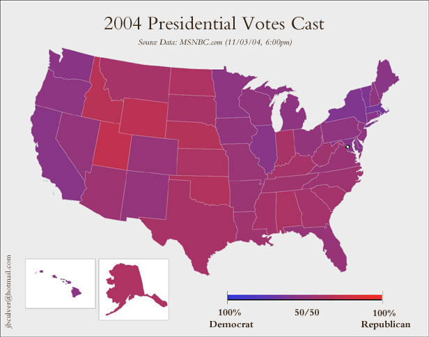
There are some interesting maps out there. This one is pretty funny. This one illustrates that differences between red states and blue states are less severe than one might imagine. However, there is a major divide, but it's not between the coastal states and the interior. It's between urban and rural areas. Take a look at this map, showing which way each county voted.
Interestingly, this means that the people most at risk for a terrorist attack voted overwhelmingly against Bush and his prosecution of the War on Terror.
Interestingly, this means that the people most at risk for a terrorist attack voted overwhelmingly against Bush and his prosecution of the War on Terror.
posted by Eshan at 1:17 PM
![]()
0 Comments:
Post a Comment
<< Home